Past
From the 1940s through the 1960s, over the protests of the local NAACP and neighborhood associations, car-oriented planning deprived local residents of the public health, cultural, and economic benefits of Druid Hill Park. Construction of the 1948 Druid Hill Expressway and 1963 Jones Falls Expressway resulted in the widening of Auchentoroly Terrace and Druid Park Lake Drive from two lane, park-front residential streets into dangerous five-to-nine-lane-wide highways.
Present
Excess lanes around Druid Hill Park encourage motorists to drive at high speeds that discourage pedestrians from entering the park due to concerns over personal safety. Druid Park Lake Drive and Auchentoroly Terrace lack safe intersections and crosswalks for residents to reach the park on foot. Sidewalks are not accessible to wheelchair riders. People who rely on bicycles and electric scooters do not have protected pathways serving all neighborhoods around the park.
Future
TAP Druid Hill envisions a future where residents of all ages and abilities are able to reach the recreational, public health, and cultural benefits of Druid Hill Park using safe and accessible “Complete Streets”. Complete Streets are streets designed and operated to be safe and accessible for all, including pedestrians, transit users, wheelchair riders, and people who rely on bicycles and e-scooters. Each complete street is different and based on the needs of the surrounding residents and neighborhood.
How?
TAP Druid Hill is bringing together diverse neighborhood groups to shape the future of transportation around and access to Druid Hill Park. By studying how people relate to our historic green space, engaging residents to redesign the highways as neighborhood-serving streets, and creating public art and events for pedestrian safety, we can begin making a positive impact now while planning long term, permanent park access improvements for the future.
PARK Study
The Druid Hill PARK survey looked at two neighborhoods that border the park and studying what it means for individuals in these communities to have access to Druid Hill Park. In addition, it informs who in the community either uses or doesn’t use the park and provided individuals the opportunity to give feedback about the relationship between the park and the neighborhoods.
Public Art & Events
In support of the Druid Park Lake Drive Complete Streets design effort, local residents, public artists, and organizers have led community walks, collaborated with neighbors to create public art for pedestrian safety, hosted bicycle repair workshops, and produced and screened the Stories for Change film series. Public artworks include an art crosswalk at Fulton Avenue, temporary light art, and a community walking parade that connected Reservoir Hill with Druid Hill Park.
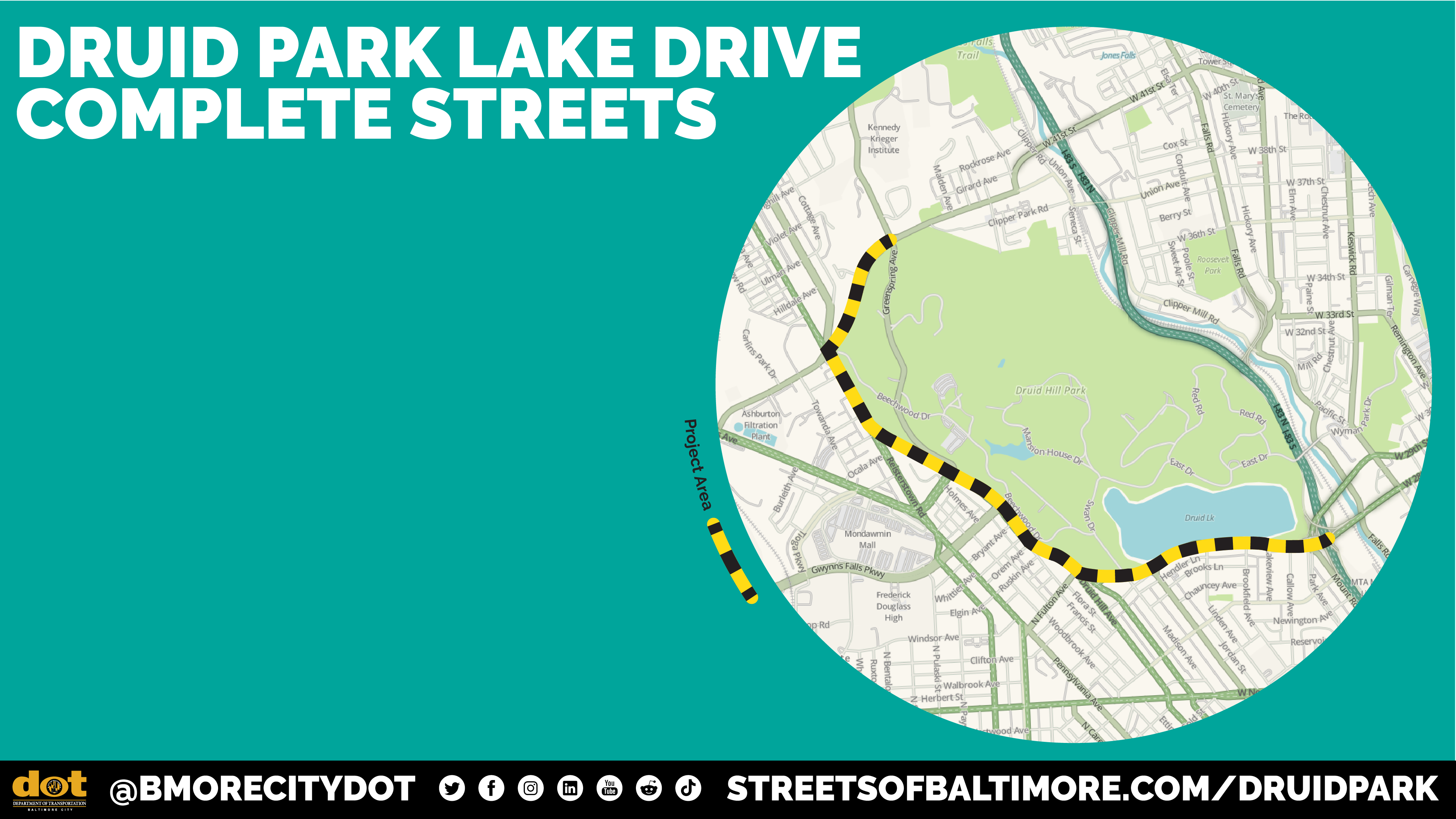
Complete Streets
TAP Druid Hill has worked with Baltimore City Department of Transportation to ensure that all residents have had a chance to contribute to the forthcoming “Druid Park Lake Drive Complete Streets” design effort. The study addresses park access around the entire park, including Druid Park Lake Drive, Auchentoroly Terrace, Reisterstown Road, and Druid Park Drive.
Stakeholders & Supporters
The TAP Druid Hill campaign is powered by a diverse, growing group of local stakeholders and partners including residents, community organizations, city agencies, non-profits, and design groups.
Latest News
Van Hollen, Cardin, Mfume Announce $6 Million for Planning to Reconnect West Baltimore Communities to Druid Hill Park
U.S. Senators Chris Van Hollen and Ben Cardin and Congressman Kweisi Mfume (all D-Md.) announced $6,000,000 for Baltimore City’s Restoring Connections to Druid Hill Park Project. This federal funding will support redesign planning for Druid Park Lake Drive in order to reconnect West Baltimore communities cut off from Druid Hill Park following the widening of the roadway over 60 years ago.
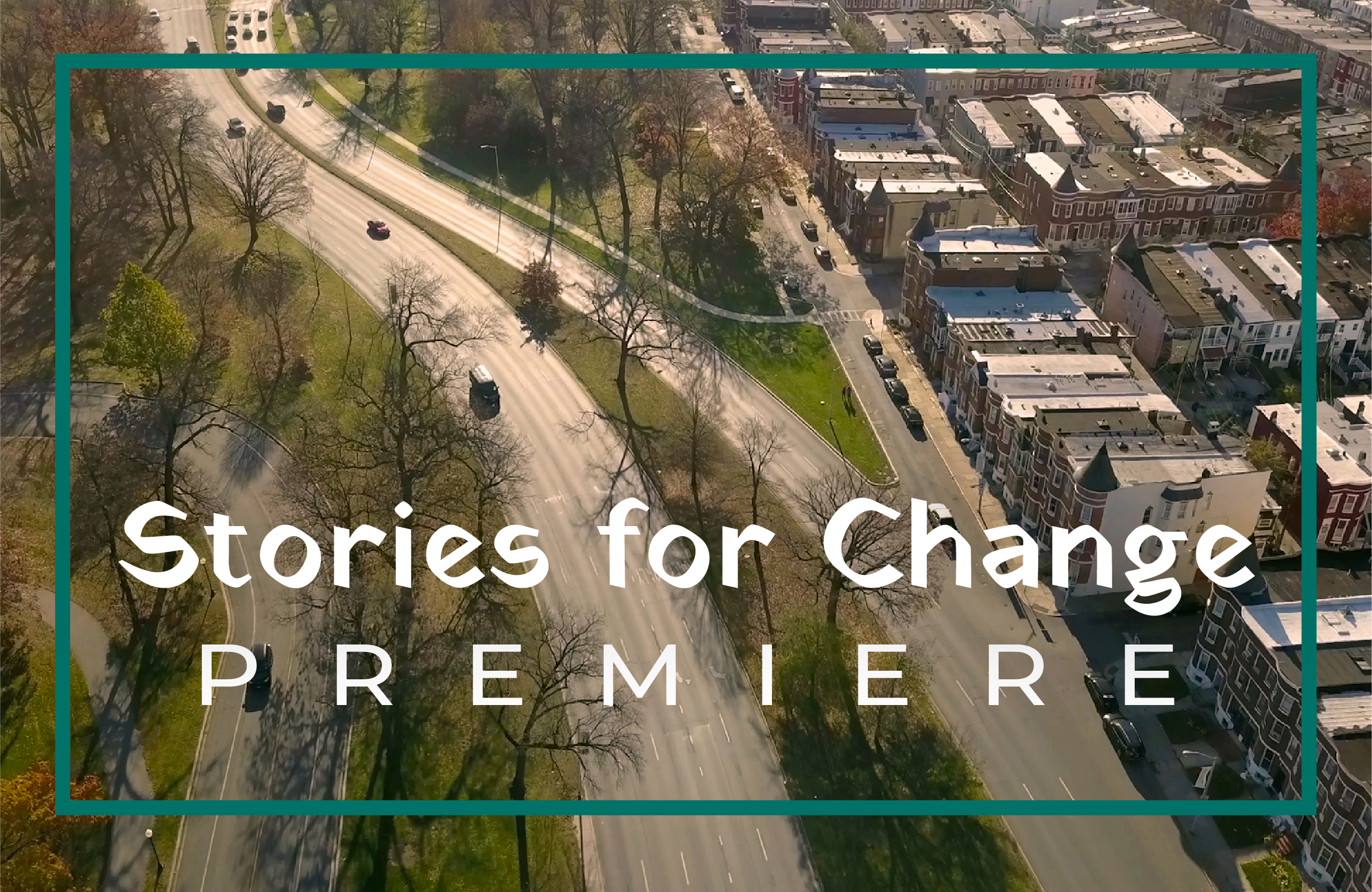
Stories for Change
Thank you to everyone for making the March 18th Stories for Change Premiere a beautiful success! Created by filmmaker Kurt Orderson with The Access Projects for Druid Hill Park (TAP Druid Hill) and the New Auchentoroly Terrace Association (ATA), the three short films of Stories for Change highlight the experiences of local residents' love for Druid Hill Park and their challenges getting to the park on foot.
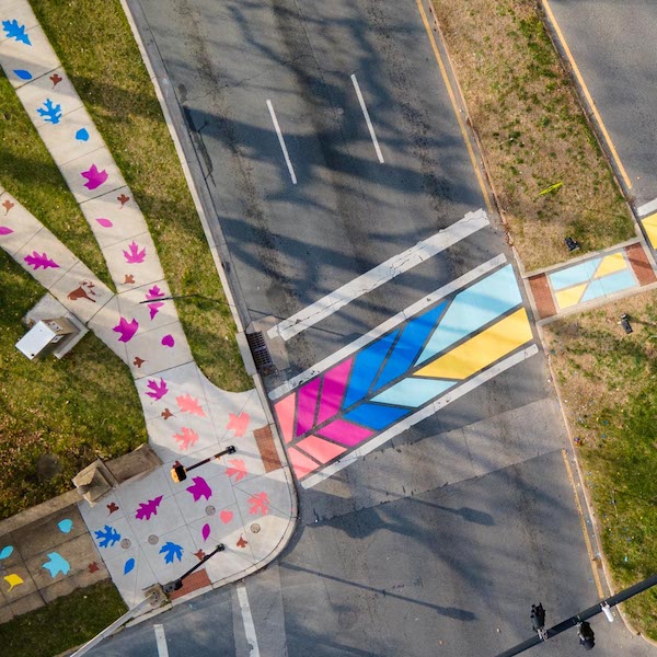
Community Creates the Druid Hill Canopy Crosswalk
On April 3rd and 4th, 2022, the Auchentoroly Terrace and Greater Mondawmin community came together to create the Druid Hill Canopy Crosswalk. This project has been years in the making. The Druid Hill Canopy Crosswalk celebrates green space access while joyfully enhancing street-crossing safety for West Baltimoreans walking to Druid Hill Park. Community members previously nominated their favorite park trees to be represented in the artwork and later co-created the project during a community paint day.
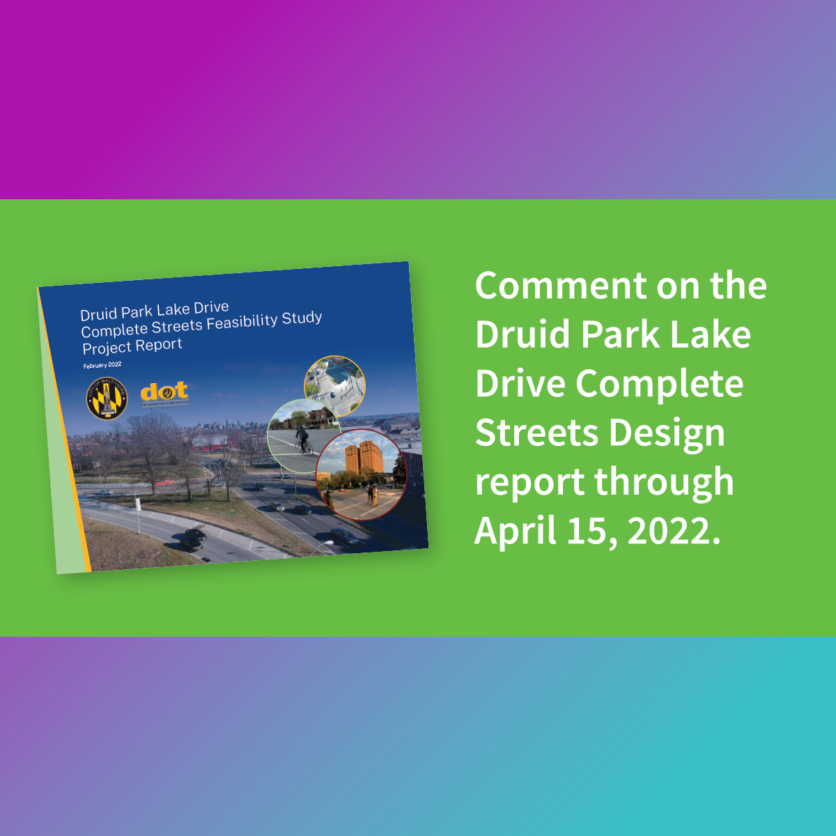
Comment on Druid Park Lake Drive Report Through 4/15
BCDOT and WSP released the Druid Park Lake Drive Complete Streets Design Effort Study Report. View the full report on BCDOT's website and submit any additional comments by April 15, 2022.
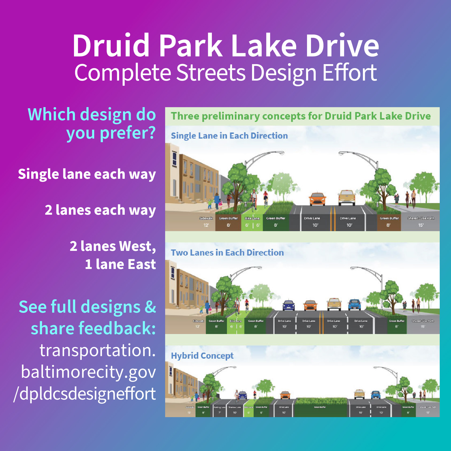
Share Feedback on Druid Hill Complete Streets Design Concepts
Baltimore City Department of Transportation has shared three preliminary design concepts for complete streets improving access to Druid Hill Park for local residents. View the design options and share your feedback by December 17, 2021.
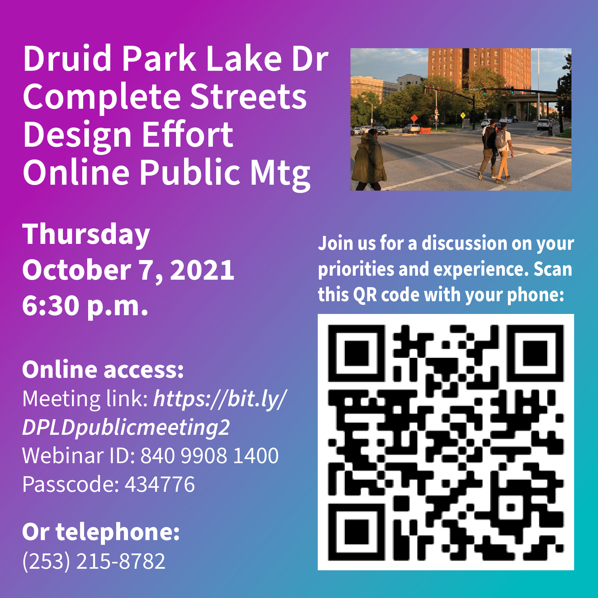
Druid Hill Park Complete Streets Public Meeting Oct 7
The Baltimore City Department of Transportation (BCDOT) is undergoing a Complete Streets planning and concept design process for the two-mile section of Druid Park Lake Drive from the I-83 ramp (Mt. Royal Terrace) to the north entrance of Greenspring Avenue. As the study nears completion, the design team is eager to share their ideas with the community and project stakeholders. Please join us for an online presentation, Thursday, October 7 at 6:30 pm. During that time the design team will share several scenarios and listen to your comments.